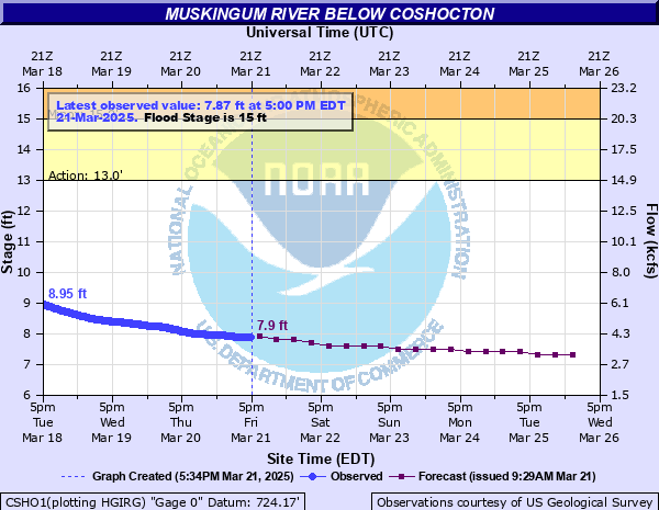
| Below Coshocton (Recent, Current and Future) |
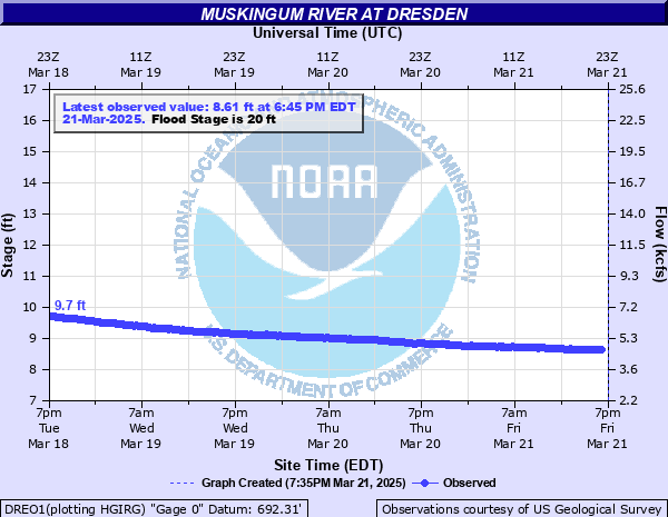
| Dresden (Recent and Current) |
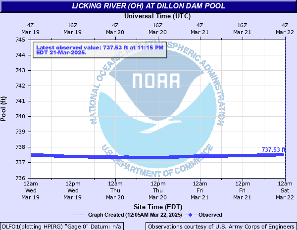
| Dillon Dam Level (Recent and Current) |
| Dillon Lake InFlow, OutFlow, Elevation and Impact Elevations |
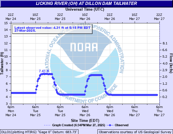
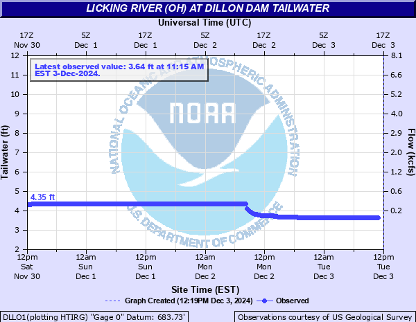
| Dillon Dam Tailwater (Licking River) (Recent and Current) |
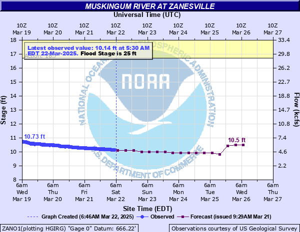
| Zanesville - Below Y Bridge (Recent, Current and Future) |
| Salt Creek Near Chandlersville (Recent and Current) |
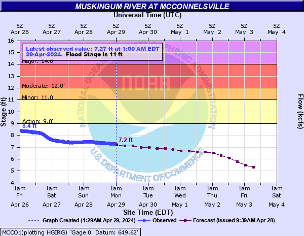
| McConnelsville (Gauge Readings Have Changed With New DAM!!!, Recent, Current and Future) |
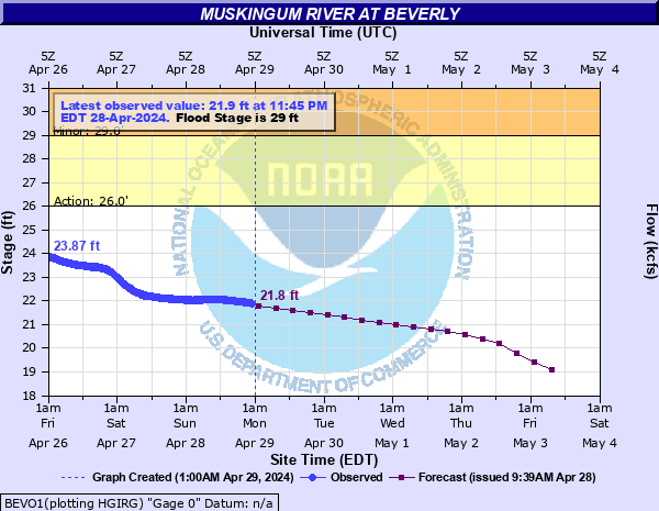
| Beverly (Recent, Current and Future) |
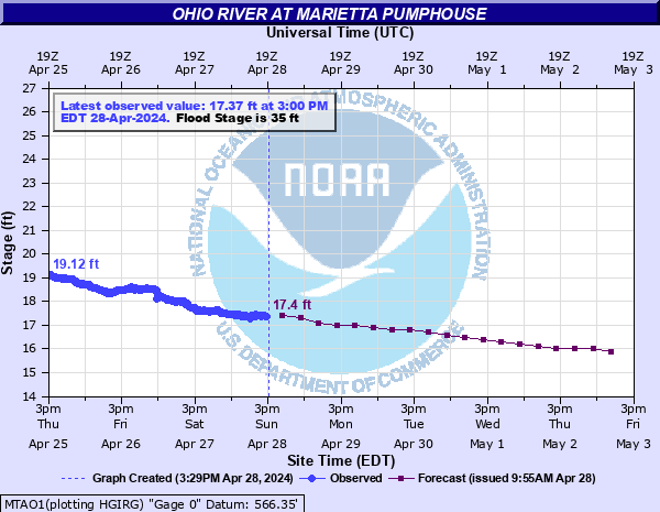
| South of Marietta (Recent, Current and Future) |
| Test Link - Recent and Current Dilon Dam Tail Water, Below Zanesville Y-Bridge, Salt Creek and McConnelsville |
| Test Link - Recent and Current All Muskingum River Gauges |
Major Tributaries - Muskingum River |